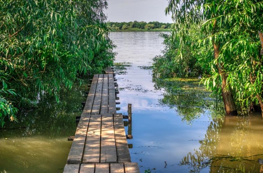
Walking routes through Odessa region were compiled by Volodymyr Poltorak, Candidate of Historical Sciences, Associate Professor of the Department of History of Ukraine, Odessa National University named after Mechnikov. Discover the following routes: Black Sea shores, Tiligul Estuary, Danube floods and Pobuzhya.
Black Sea
from Grigorivka to Chernomorskoe (9 km)

This is a short one-day route by the sea. You can start it near the monument to the Grigoriev landing, which took place in September 1941. Here there are buses from Odessa to the city of Yuzhny. The trip ends on the same South-Odessa road within the village of Chernomorskoe.
High shores under always look different. The waves form a unique look of the pristine Black Sea coast. Sandy lagoons, limited by such blocks are very picturesque. Vegetation also gives this place uniqueness. Algae, mosses, bushes and trees intertwine in a whimsical dance.
Carefully moving forward, pay attention to the gifts of the sea - here washes bullets and shell casings in 1941, you can often find traces of the sea catastrophes.
Climbing to the high shore and crossing the highway, inspect the remains of 412 artillery batteries - concrete bunkers, artillery positions, memorial to the events of 1941.
It is best to take this route in summer, because there are waves are higher in spring and autumn and the water reaches not quite comfortable temperature.


Tiligul Estuary
from Yuzhny to Koblevo (13 km)

One-day route between the seaport Yuzhny and the resort the village of Koblevo. The trip takes place in two regions: Odessa and Mykolayiv. The connection of Odessa to Yuzhny and Koblevo is enough available and equipped with a large number of buses.
The trail winds along the high shores of the Black Sea to the east of the South. Therefore, it is forbidden to go to the edge of the cliff; it is dangerous, because the top layer of soil may look quite reliable, but under it, in fact, already gapes emptiness. Because the views from the height of such cliffs are amazing and fascinating breath - so you should be very careful not to fall into the trap.
To the north of the route in the direction of the village of Koshary rises a mound, which archaeologists have nicknamed the Master - he really seems to command everything surrounding space. It is part of the necropolis of the ancient Greek town, which according to archaeologists is an ancient Odessa. Odessa mentioned in many written sources in particular in the periplasms. Peripli is a descriptions of sea routes used by the ancient Greeks following to unknown lands.
Excavations in Odessa have been going on for several decades. It is already known that the city was a part of the possessions of the city of Olbia and was inhabited by a mixed Greek-Barbarian population. It lasted for several centuries and was destroyed by the nomads.
The Tiligul seaside and the Koblevo seaside are rich in different species migratory birds. It is better to observe them with a special optical devices. In summer period it is possible to place here the sea camp for the night.


Danube Floods
from Kiliya to Vilkovo (42 km)

This is a two-day or even three-day route from the district center of Kiliya to the famous tourist town of Vilkovo.
It passes through a lowland formed by river silt and sea sand. Two thousand years ago there was the shore of the Black Sea, and Vilkovo "appeared" on land in general for 300 years so.
The tour of the city of Kiliya should start from the Intercession Cathedral next to bus station and then proceed to the medieval Orthodox church St. Nicholas, who in 1648 restored the future father-in-law of Hetman Bohdan Khmelnytsky is the Moldavian owner Vasyl Lupul. Bogdan himself probably also visited Kiliya. In 1620 he was captured by the Turks and was brought to Istanbul, where he waited two years for the ransom.
In the central park of Kiliya there are two lakes, a moat of the mighty Kili fortress. In the 15-18 centuries the city was a center of international trade and had few powerful fortifications comparable to the Belgorod-Dniestrovsky. Unfortunately they did not survive.
The route from Kiliya goes east parallel to the state border. Here in 1950- In the 19th century a flood shaft was built, along which lines can still be seen barbed wire with equipment for starting electric current. Through the village of Lisky the road leads to a coniferous forest planted on sandy spit, rich in autumn mushroom season. At the end of the route you should see the city on the water: Vilkovo.


Aged Oks of Pobuzhya
from Kamyany to Slyusarevo (43 km)

The route was made for two or three days, because its total length is 42 km. It can also be divided into two equal parts: a separate forest part from the highway Odessa-Kyiv to Savran and Pobuzhzhya, from Savran to Kamyany.
The area is famous for the fact that the largest forest is located here in the South of Ukraine, Savransky forest.
It has attracted people since ancient times. Here on the shores of the Southern Bug one of the first agricultural settlements of Eastern Europe and Ukraine was found Neolithic era. Burial mounds of nomads of different epochs have been preserved from the Cimmerians to black hoods.
A battle between the Polish and Tatar armies took place on the Yalanets River 1489, in which "local Cossacks" took part for the first time. This is the first written mention of the Ukrainian Cossacks.
In the 19th century, the first school of bandura players operated in Savran. One of the teachers of this school, Timko Padura, wrote in Pobuzhye famous Polish song "Hey, falcons". The picturesque shores of the Southern Bug are complemented by granite cliffs and thresholds. Here is also a small hydroelectric power plant.
On the left side of the Bug is a graphite deposit. It is the second in the world and the first in Europe in terms of explored reserves. Quarries and heaps in Zavallya attract tourists quite an impression of its grand size. The area is famous for its fisheries: fish, crayfish and mushrooms.


