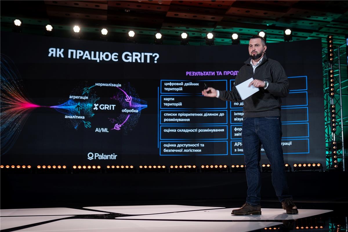

The national digital platform for planning, prioritization and monitoring of humanitarian demining — GRIT — was presented at the third Demine Ukraine Forum held on 5 December in Kyiv. Deputy Minister of Economy, Environment and Agriculture of Ukraine Ihor Bezkaravainyi explained which data the platform uses, what tasks it can already perform and how it will be integrated into mine action processes.
“Ukrainian experts and researchers in ecology, economics, social sciences, geoinformation systems and data engineering are working on GRIT’s development. With AI tools, powerful infrastructure for analytical modelling, and a solid understanding of mathematics and logic, they can answer a huge number of questions about the current state of territories and their future development. All necessary information is provided in convenient formats, enabling comparisons and tracking dynamics,” Bezkaravainyi said.
GRIT creates a digital twin of every plot and uses analytical models to support evidence-based decisions based on real, up-to-date data. During the presentation, Bezkaravainyi demonstrated an example: a single potentially contaminated area of about 6 hectares can block 137 cadastral plots with a total area of over 200 hectares. Owners cannot cultivate their land because some parts may contain remnants of war. Prioritizing the clearance of this one site would immediately return 200 hectares to use and restore economic activity.
Another example the system can handle is identifying priority contaminated areas within a 5-kilometre radius of schools where most students attend in person — crucial for the safety of both teachers and children.
“For the government, GRIT is a way to shape demining and recovery policy based on the most current data. For communities, the platform can support optimal development, reconstruction and land use after clearance. Businesses can receive a digital profile of a plot they plan to use, and mine-action operators can access soil maps, land cover data and satellite imagery analysis to plan operations effectively,” Bezkaravainyi noted.
GRIT is planned to be integrated into the annual humanitarian demining planning cycle. Verified data will enable the government to prioritize those territories where clearance will bring the greatest benefit.
Background: GRIT (Ground Rehabilitation through Innovation Technologies) is the national digital platform for planning, prioritizing and monitoring humanitarian demining, built on the Palantir technology base. It currently uses more than 20 datasets from state and commercial registers, satellite data and operators’ inputs, with further capability expansion planned next year.